
Run the Alps App: How to Get Around Self-Guided
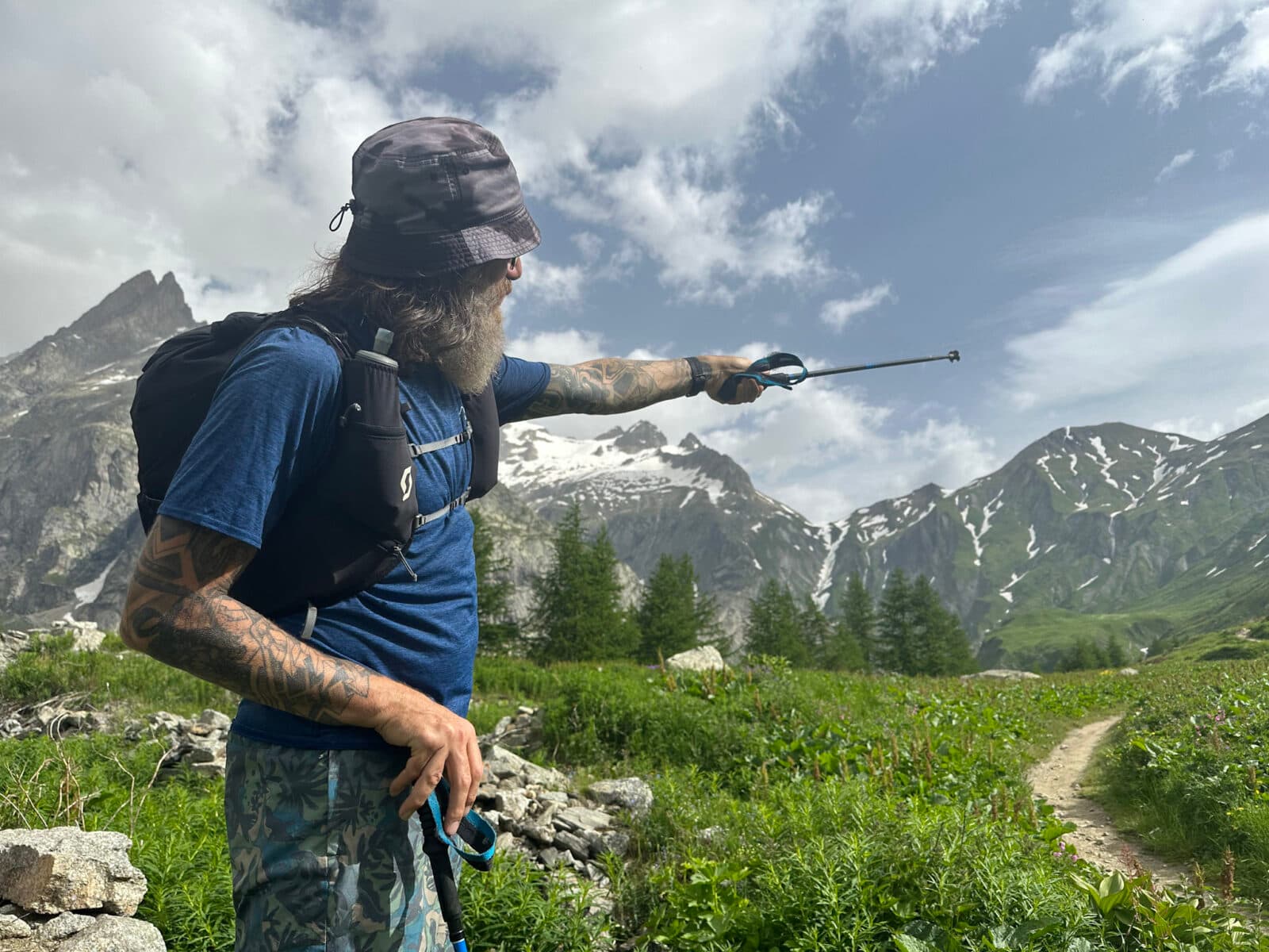
Top photo: Devorah Holan
There’s a quiet revolution underway with our Run the Alps self-guided trips. It’s time to share the news a bit more publicly.
It’s our new Run the Alps app.
For years, Run the Alps produced detailed waterproof, printed route descriptions, maps, and interpretive materials for our self-guided guests.
Now, we’ve switched it all up and gone digital. No more crumpled sheets of paper in your trail running vest, no more squinting to figure out just where on that dashed red line you might be.
Our self-guided trips are much better for it. Less worry, more confidence– and more time to run.
Curious how it works? Let’s take a look around.
Using Run the Alps App on your Self-Guided Tour
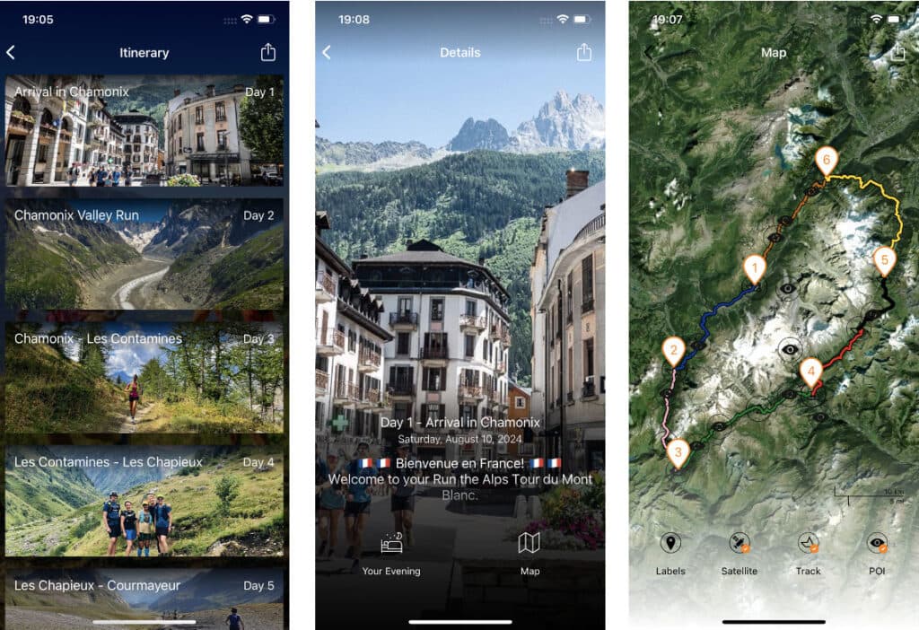
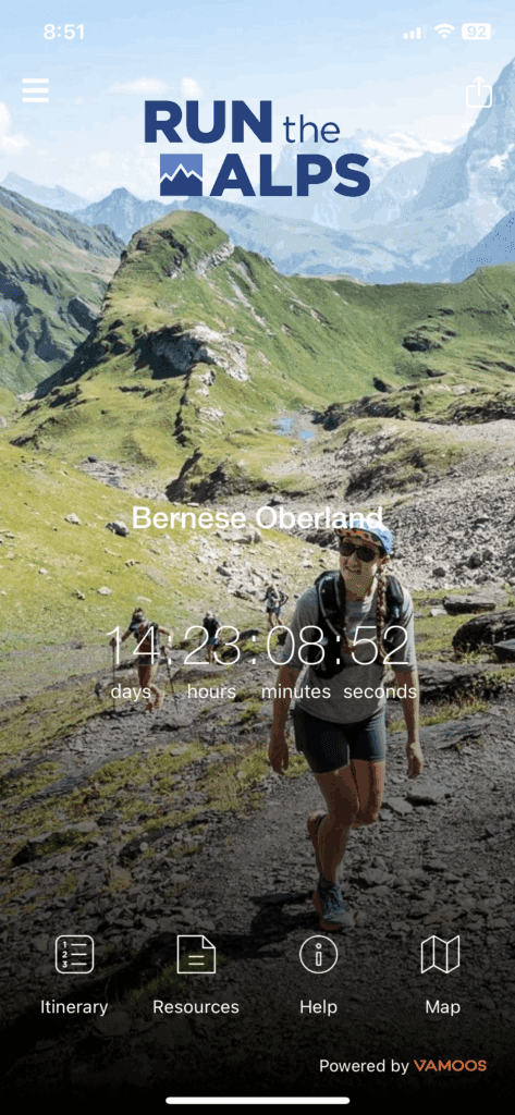
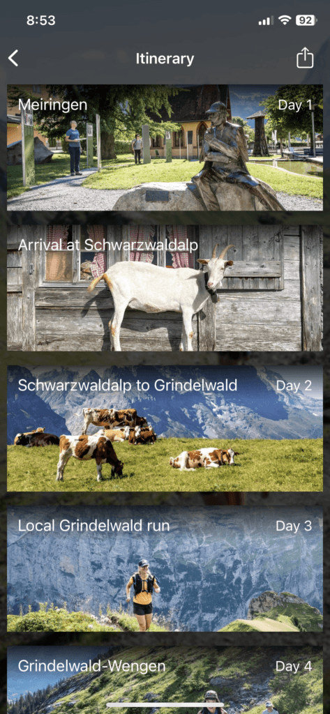
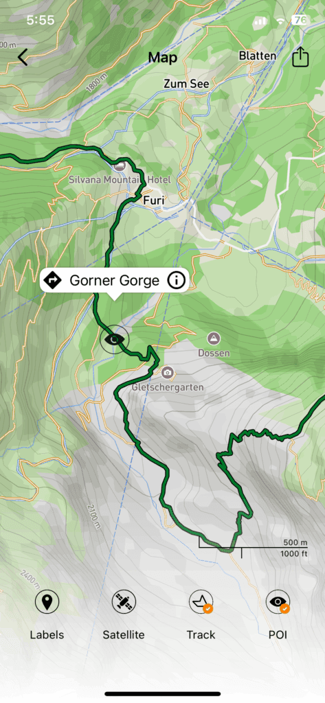
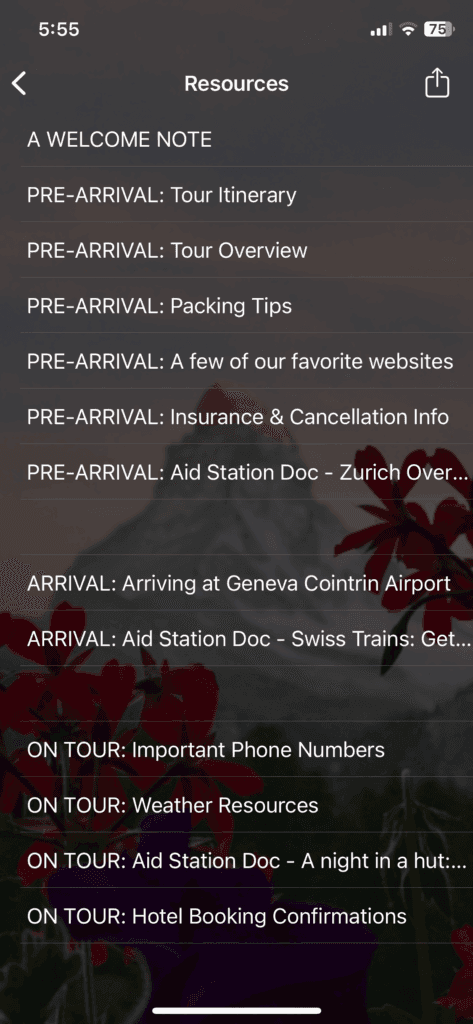
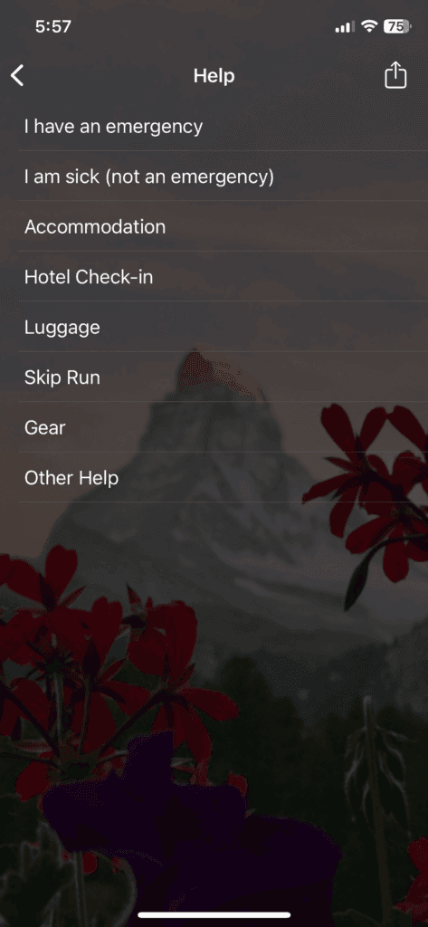
We’ll send you the link to our app and login details via email a few weeks before your self-guided tour. Through our app, you’ll have access to all the resources you need along the way. Included in the app are your run descriptions and Village Guides, as well as a Help section that will provide you with guidance in the unlikely event that you have a problem during your tour. You’ll also find confirmations for all your pre-arranged logistics—such as accommodations, taxis, and baggage transfers. The map feature allows you to easily locate your hotel each night and find a restaurant for your evening meal, as well as provides you with valuable On the Run points of interest such as water sources, shelter, and ways to shorten your run for the day.
Once the Run the Alps app is downloaded to your phone, there’s no need for a cell connection. If a route changes during the summer, Run the Alps will shoot you a quick notification, and push an update of the app your way the next time your phone finds a wifi or cell connection.
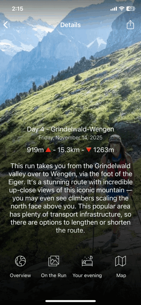
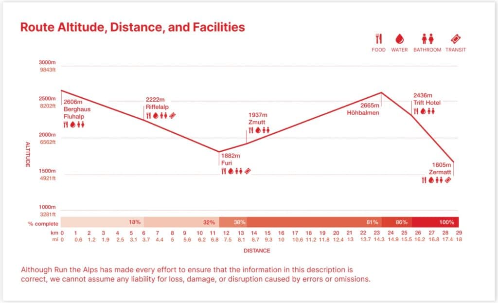
On the Run
A mobile friendly PDF gives you turn-by-turn directions:
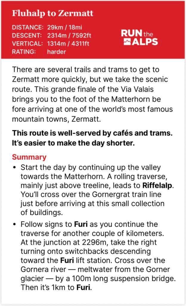
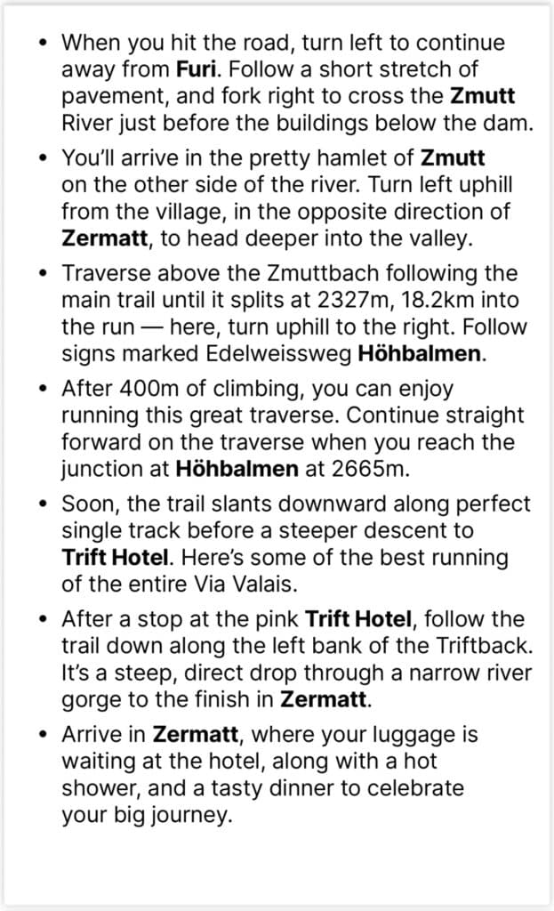
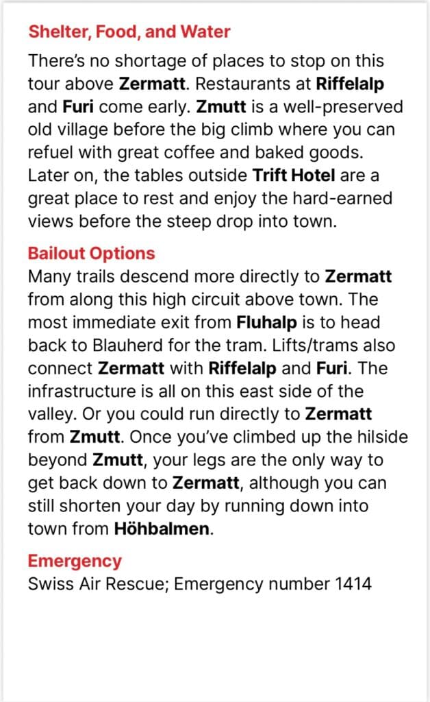
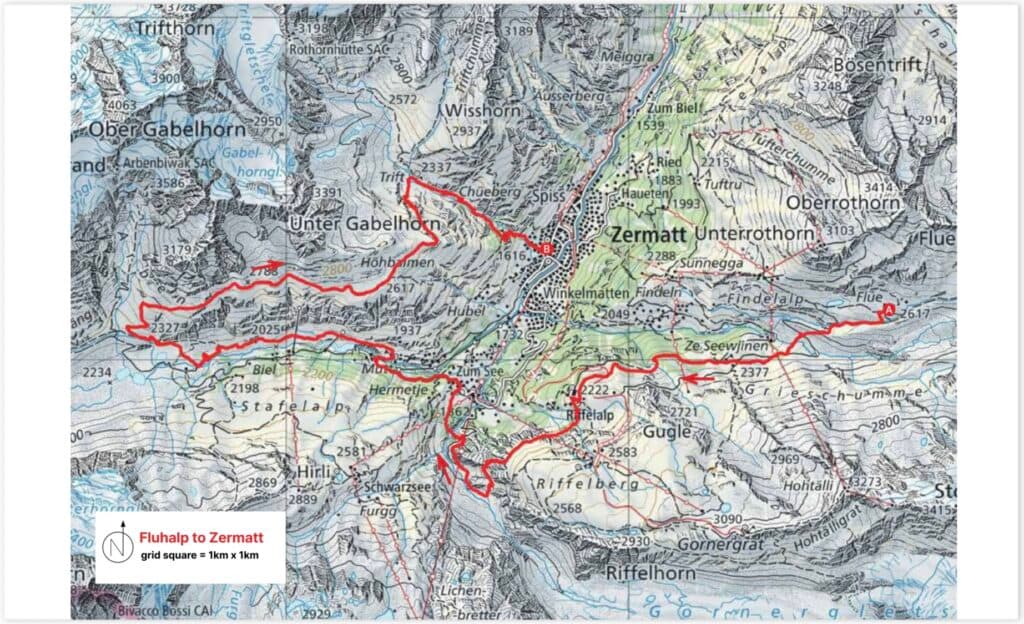
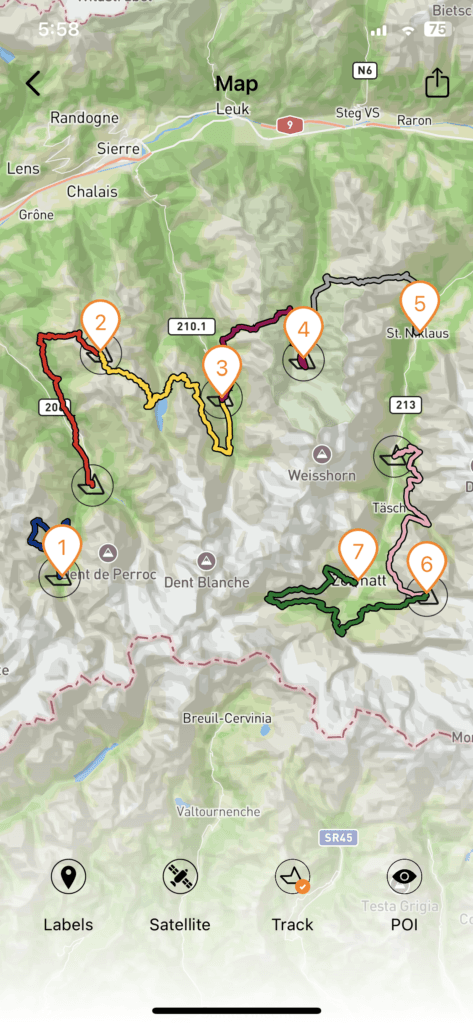
Mapping and additional resources
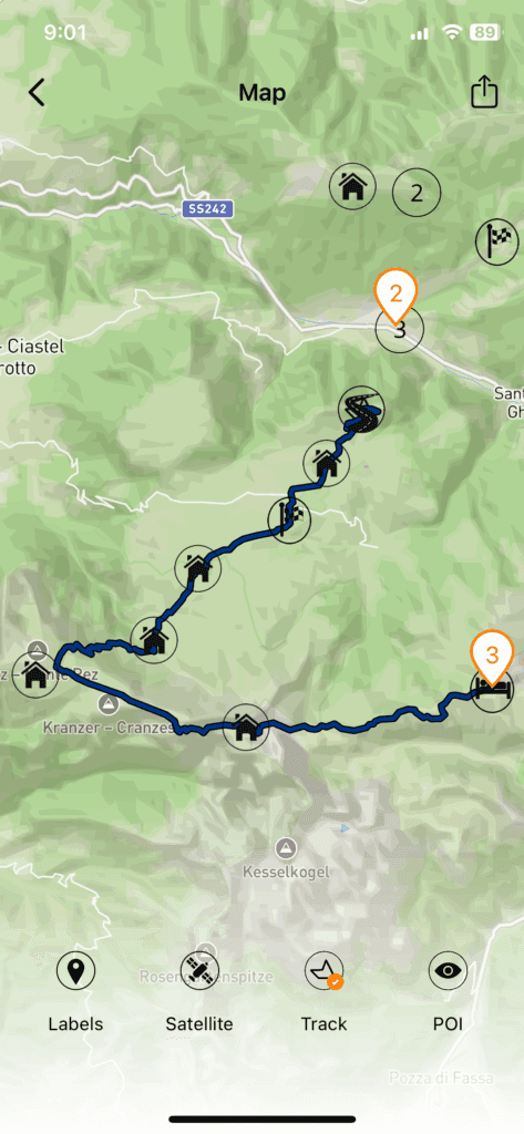
Look though a Dolomites Tour
App-reciation
All of us at Run the Alps love our Run the Alps app, as do our guests. Here’s what they had to say about it:
“The GPX files were great, the app was extremely helpful, the recommendations were great!” — Anonymous, Tour du Mont-Blanc
“The app and printed material made it so simple.” — Martin, Via Valais
“We just followed the red line!” — Eleanor, Tour du Mont-Blanc
Sorry, the app will not find you cows in real time, or order your tarte myrtille with a cafe au lait at the local hut. That you have to do on your own– until we launch version 2.0, that is.
Oh, and about that paper? If you’re still like some of us– myself included– and want to clutch something less tech-y in your hands, we’re still producing the old school tour materials, too. They’re included when you sign up for a Run the Alps self-guided tour for 2026, and will be available at our cost starting in 2027.
The Run the Alps app is produced by our partners at Vamoos, and implemented by Ian Mills. Nice work, team!
